


Kainuu Trail 55 km Värikallio - experience and feel the most finest trails of Hossa
Published: 04.02.2022
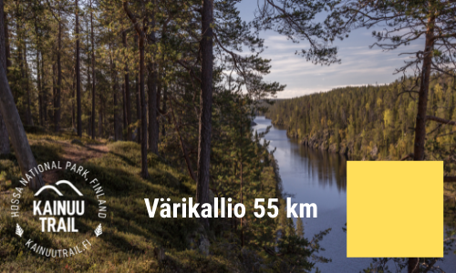
The Kainuu Trail 55 k Värikallio route offers majestic serving of Hossa National Park’s finest trails, greatest views and sightseeings - starting from Julma-Ölkky canyon to Värikallio’s Rockwall Paintings for example. In this route description, we’ll tell you the most important terrain and route hints to make you prepare for this memorable trail route a little bit easier.
Kainuu Trail 55 k Värikallio
Distance: 54,90 km
UTMB Qualifier 2022: Qualifier 50K
ITRA-pisteet: 2
Mountain-points: 4
Total elevation: +1980 m
Aid stations: 5 + maali
Start and finish area: Hossan luontokeskus
Start time: saturday at 08.00am
Maximum time: 14 h (finish is closed at 22.00pm)
Route markings: Yellow
Route map: See route map from here
More info: Kainuu Trail routes and maps -webpage
Presentation video: Kainuu Trail 55 km presentation video
Start - Iso-Valkeainen (1st Aid station), 8,8 km
The first part of the route runs from the pine-forest needle trails in the vicinity of the Hossa Visitor Centre through Iikoski River, following the shores of Lake Huosiusjärvi to the Torkonluikea River and from there along Hakoharju towards the first aid station (service point) in Iso-Valkeainen.
The first 200 meters and steps runners will have on the asphalt-paved Jatkonsalmentie, after which the running route leads to the needle trail next to the Road Iikoskentie. Trail follows very closely the Road Iikoskentie about 1.5 km until the crossing of the Iikoski bridge. 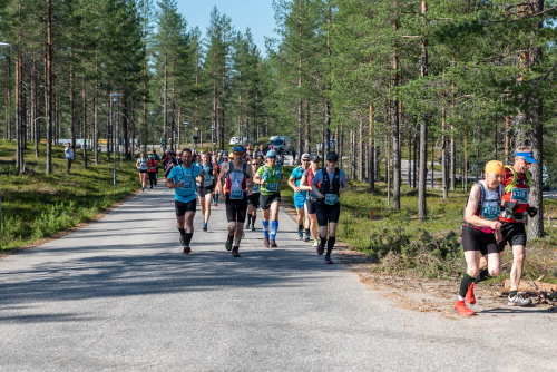
The only asphalt section of the route is on the Kainuu Trail's start (approx. 200 m)
Immediately after crossing the Iikoski bridge, the route turns sharply to the left towards Lake Huosiusjärvi. This needle path, which teases the feet and eyes of a trail runner, runs in a pine-forest and it lasts about 3.5 km to the western end of Lake Huosiusjärvi. At the end of the section, the route crosses the Torkonluikea rapids, and immediately after crossing the rapids, the first slightly tighter ascent of Hakoharju, about 150 m long and 25 m high, is coming up. On the Hakoharju, the 55 km route (as well as routes 21, 38, 78 km) turns sharply to the right backwards. So far, the running distance from the start is 5.4 km.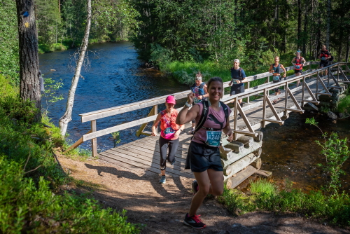
Crossing the River Torkonluikea at the western end of Lake Huosiusjärvi
The next 3.4 km section will be enjoyed by the fine pine-dominated ridges and, in the meantime, by diving into the river rapids in the ridges. Absolutely great scenery points in this area are Hakokoski and Suottavirta.
Hakokoski, Hossa National Park (Photo: Suomussalmi municipality / photographer: Jonna Saari)
Of course, the scenery to Syvä-Hoilua from the top of Hakoharju, for example, is also quite amazing. About 400 m before the first aid station in Iso-Valkeainen, the route arrives at the edge of Pieni Hossalaislampi pond, from where it turns left to turn around the pond towards the first service. The route arrives at the aid station along a small path on the right side of a larger road. At the Iso-Valkeainen aid station, the Kainuu Trail trail’s distance is 8.8 km from the start.
Iso-Valkeainen - Julma-Ölkky (2nd aid station), 9,4 km (total 18,5 km)
From the Iso-Valkeainen, the journey continues to the right along the Road Pistonlehto for about 1 kilometer; the same stretch of road will also be returned when the Julma-Ölkky loop is completed. After 1 km running at the Road Pistonlehdontie, the route turns right to the shore of Lake Umpi-Valkeainen and from here on to the right around the lake. On the other side of the lake, the route goes up to Laukunharju.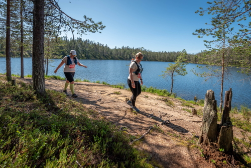
On the Umpi-Valkeainen beach path, it is nice to put a foot in front of another
Just before ascending to Laukunharju, the trail is at its narrowest and sometimes the trail has a few fallen old trees bringing variation to the running rhythm. From the top of Laukunharju, the route descends sharply at Laukunsalmi to the shore path leading to Laukkujärvi; at the same time, the landscape changes from pine-dominated trees to spruce forest. After Lake Laukkujärvi, the route continues along the River Somerjoki towards Lihapyörre. At Lihapyörre, the distance is a total of 14.2 km.
Good to know: At Lihapyörre, the 38 km route has a turning point, while the 55 k and 78 k routes continue directly along the Somerjoki towards Lake Ala-Ölkky.
Kainuu Trail 55 k Värikallio route map between Iso-Valkeainen - Lihapyörre
From Lihapyörre, the route continues along the Somerjoki River towards Lake Ala-Ölkky. Just before Ala-Ölkky, the route turns sharply to the right towards Julma-Ölkky - and a couple of hundred meters from this turn the route crosses the Somerjoki bridge. After the bridge, the terrain type changes again from a spruce forest to a pine-dominated forest terrain, from which it is only two kilometers running to the Julma-Ölkky aid station. The aid station is 100 meters before the road of Julma-Ölkky and at the aid station the total distance is 18.5 km.
Ölökyn Ylitys - 5 km hiking trail - Julma-Ölkky (3rd aid station), 5,5 km (total 24,0 km)
See Ölökyn Ylitys hiking trail description from nationalparks.fi-pages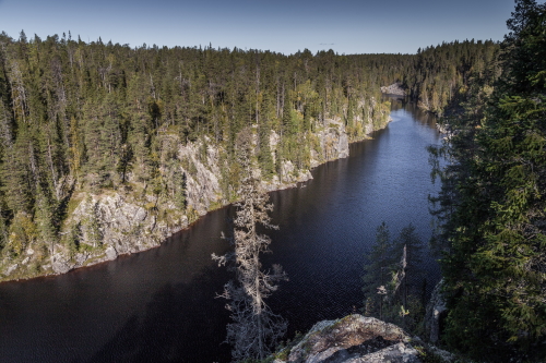
The landscapes of Julma-Ölkky rewards the trail runner’s effort (Photo: Suomussalmi.fi /photographer: Antti Kulmanen)
After the Julma-Ölkky aid station, the running route crosses the Julma-Ölkky road and continues straight to circle around (counterclockwise) the Ölökyn Ylitys hiking trail (first to the east side of the Julma-Ölkky canyon lake). After 2.5 km running the route will turn tightly left (before Ölkynhaara) towards the cable bridge over the canyon. Before crossing the cable bridge runners will go down to the canyon by using metallic strairs on the eastern side of the canyon. On the cable bridge only 1 person at the time can use the bridge due the safety regulations (minimum 10 meters to the next runner). After crossing the cable bridge runners will ascend western side of the canyon and on the top the 55 k route turns left towards Julma-Ölkky aid station which will be 2.5 km distance from this point.
Julma-Ölkky is the most challenging section on the Kainuu Trail 55 km track. The terrain is very hilly and rocky with steep descents and ascents. However, the trails are very good to run, especially on the section Julma-Ölkky - Ölkynhaara, where there is a cable bridge over the Julma-Ölkky canyon lake. Sceneries of the canyon lake crowns the atmosphere of trail running.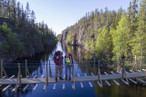
Julma-Ölkky’s cable bridge is used only in 55 k route
After Ölökyn Ylitys hiking trail, the Kainuu Trail runners will arrive back to the Julma-Ölkky aid station, where they have already in total 24.0 km distance behind.
Julma-Ölkky - Värikallio - Iso-Valkeainen (4th aid station), 10,9 km (total 34,9 km)
After the second aid station visit in Julma-Ölkky, the route continues along the same route of about 2 kilometers to the crossing of the Somerjoki River as according to the arrival route to Julma-Ölkky. From the next cross-road, the route turns right towards the Naava-covered spruce forests leading to Värikallio.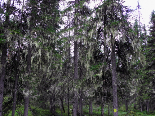
Old spruce trees covered by Naava “Beard lichens” at Mieskallionvaara near the Värikallio (Photo: Suomussalmi municipality)
At Värikallio, at the eastern end of Lake Somerjärvi, the Kainuu Trail track turns sharply to the left just before the actual sightseeing - Värikallio rock paintings; so if a Kainuu Trail runner wants to go and see Värikallio’s famous rock paintings, then it’s worth taking the time for this trip either before or after the Kainuu Trail event. From Värikallio, after a 150-meter run, a 75-meter-long stairs to the Mieskallionvaara begins. In this short stairs section, a total of 25 meters of ascent will be awarded, so the thighs will thank the runner.
The stairs of Mieskallionvaara awaits runners after Värikallio (Photo: Suomussalmi municipality)
From Mieskallionvaara, runners can enjoy the gentle downhill along the pleasant paths along Korkeakangas towards Lihapyörre and from here on through Laukkulampi pond and Valkeaisenkangas, continuing back to the Iso-Valkeainen aid station. When runners arrive at the Iso-Valkeainen aid station for the second time, the total distance is 34.9 kilometers.
Iso-Valkeainen - Muikkupuro - Kokalmus (5th aid station), 7,3 km (total 42,2 km)
After the second aid station visit to Iso-Valkeainen, the runners head towards the legendary Muikkupuro and its crystal clear natural waters. Muikkupuro is 1.5 km from the Iso-Valkeainen and mostly at this section runners can enjoy the fine grounded trail.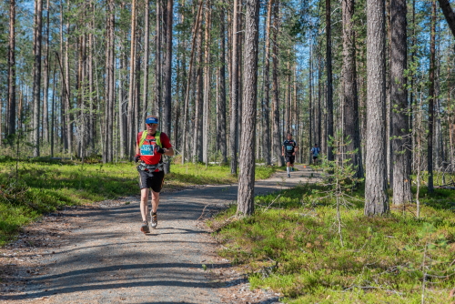
Path to Muikkupuro is mostly in very good shape
The last 400 meters before Muikkupuro 55 km track runs to a little bit smaller path and to the shore of Iso-Valkeainen, but this smaller path is also in a very pleasant running condition - like all other needle paths in Hossa :).
Just before Muikkupuro, Kainuu Trail runners will enjoy this path
After crossing the Muikkupuro (and the lean-to), the route continues along the shore path of Lake Keski-Valkeainen towards the wilderness hut of Ala-Valkeinen.
Muikkupuro’s crystal clear water is drinkable (Photo: Kainuu Trail / Jukka Liuha)
At the Ala-Valkeinen wilderness hut, the running route turns sharply to the left on the Valkeainen ridge, and from there, after a 250-meter run, turn right towards the very nice ridge and scenery of Hoiluansärkkä.
KUVA
Runners will cross this bridge by arriving from the Ala-Valkeinen wilderness hut’s side
KUVA
Nice view of Hoiluansärkkä (Photo: Suomussalmi municipality/photographer: Jonna Saari)
On the Hoiluansärkkä, the Kainuu Trail track runs between Lake Ala-Valkeainen and Lake Pitkä-Hoilua, forwarding towards Lake Kokalmus. After circling the Kokalmus Lake, Kainuu Trail runners can enjoy the traditional and beautiful lake landscape of Kokalmus Bay and the services of the Kokalmus aid station. When the 55 km route is reached to Kokalmus, a total of 42.2 kilometers have been run.
Kokalmus aid station - trail runner’s paradise in the middle of wilderness
Kokalmus - Pitkä-Hoilua - Jatkonvaara - Huosius - Finish, 12,9 km
After the Kokalmus aid station, the 55 k runners will run towards Lake Lounaja and Lipposensalmi lean-to a shelter. After 100 meters of the lean-to, the Kainuu Trail track turns 90 degrees to the left from the t-shape crossing towards the shore-sceneries of Lake Pitkä-Hoilua (see map).
Good to know: At this t-shape crossroads the official Hossa’s hiking trail markings continues straight (as the Kainuu Trail turns to the left), so there are no Kainuu Trail signs on the direct path and access to the direct path is blocked by a signpost.
Kokalmus lakeside landscape at Kokalmusperä

Path after the aid station of Kokalmus (Photo: Kainuu Trail / Jukka Liuha)
The Kainuu Trail’s track on the shore of Lake Pitkä-Hoilua is enjoyed for about 3 kilometers, after which you turn again 90 degrees from the t-shape crossing - this time to the right towards Jatkonvaara (see map).
At this crossing, the 38, 55 and 78 km routes meet the 21 km track’s route. Both routes turn towards the Jatkonvaara.
Good to know: Also at this crossing, the official hiking trail continues straight to the north, but the 55 km (and 38 and 78 km) Kainuu Trail signs do not guide you to run straight, but instead turn right towards the ascent of Jatkonvaara hill. The Kainuu Trail 21 k track will come from the opposite direction of the Pitkä-Hoilua’s shore path to the same crossing, but these signs will only be visible from the north for 21 k runners. The crossing also has a “traffic divider” made of signposts so that runners arriving from both directions turn towards the ascent of Jatkonvaara.
After the crossing, the trail heads towards Jatkonvaara and there will be a one kilometer long continuous ascent (total elevation 60 meters) to the top of the hill. On top of the hill, the path dives into a small slope, from where it ascends another steep climb to the crossroads of Kainuu Trail and the Hossa’s official hiking trail. This path from Pitkä-Hoilua to the intersection of the official hiking route is one of the weakest (in condition) in Kainuu Trail (but still runnability is good); the path is in a weak condition because it has not been an official hiking route since 2017.
Down from the top of the Jatkonvaara hill, runners can enjoy comfortable and relaxed downhill running towards Huosius. About 500 meters before Huosius, the route crosses the dirt road Pistonlehto and a few hundred meters later it joins the 10 k track’s route at the Lake Huosiusjärvi campfire site. Here it turns right towards Jatkonsalmentie and the Huosivirta bridge, which is located in the northern corner of Kenttäjärvi (see map).
At Huosius, all Kainuu Trail routes will have 4 kilometers into finish
Good to know: As a result of the customer feedback we received after the first Kainuu Trail in 2021, we have now added an independent water point (not an official aid station) to Huosivirta bridge starting from 2022. This additional water refilling place will serve all participants in the Kainuu Trail, regardless of the track.
After crossing the Huosivirta bridge, the route turns sharply to the left along small stairs that rise towards Huosiusharju. In the last four kilometers before the finish, the Kainuu Trail runners will get an experience to “enjoy” the surprisingly tense ascents and descents of Huosiharju. Although this section is surprisingly tough and tests the endurance of the trail runner's physical and mental capacity, Huosiharju’s eye-catching postcard landscapes with the crown of the Huosilampi pond’s landscape will provide strength and energy for the last meters - from Huosilampi shore you can already hear the Kainuu Trail’s speaker calling from the finish and competition centre.
The Kainuu Trail route on the east side of the Huosivirta stream (Photo: Suomussalmi municipality / photographer: Antti Kulmanen)

In the northern corner of Huosilampi pond, the route turns sharply to the right to turn south and to circle around Huosilampi (background you can see Huosilampi)

Huosilampi will be circled around almost completely before reaching the finish line

Huosilampi view about 1 kilometer before the Kainuu Trail finish

Duckboards and Kainuu Trail signs guides towards the finish (500 m before finish)

The last ascent is 250 meters before finish

There it is - Kainuu Trail finish
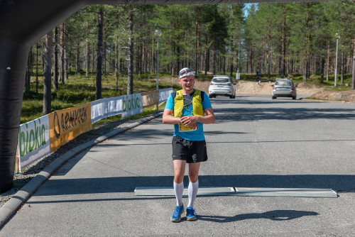
55 k runner crosses the finish line in 2021 Kainuu Trail
Get familiar with the Kainuu Trail distances, routes and maps
Read the Kainuu Trail race instructions
See from here Kainuu Trail aid stations
Check out Kainuu Trail equipment and gear
Kainuu Trail entry and registration
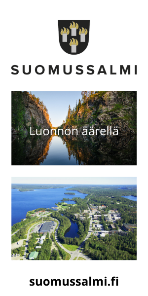
Welcome to enjoy trail running in a beautiful Hossa National Park, Kainuu, Finland!