


Kainuu Trail 10 km Huosius - enjoy Hossa’s nicest needle paths in this sprint distance
Published: 28.05.2022
Kainuu Trail 10 km Huosius - enjoy Hossa’s nicest needle paths in this sprint distance
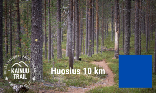
On the Kainuu Trail 10 k Huosius route a trail runner can enjoy Hossa’s smoothest needle paths, nice ridges and crystal clear water surroundings. In this route description, we’ll tell you the most important terrain and route hints to make you prepare for this 10 k trail running a little easier.
Kainuu Trail 10 k
Distance: 10.10 km
UTMB Qualifier 2022: -
ITRA-points: 0
Mountain-points: 3
Total elevation: +310 m
Aid stations: finish
Start and finish area: Hossan Visitor Centre
Start time: saturday at 10.00am
Maximum time: 3 h (finish is closed at 10.00pm)
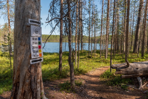
Route markings: Blue
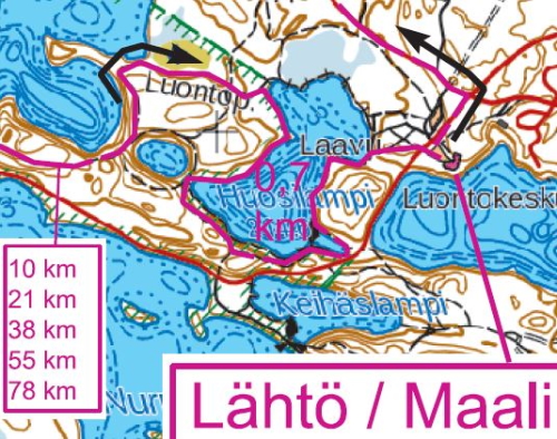
Route map: See route map from here
More info: Kainuu Trail routes and maps -webpage
Presentation video: Kainuu Trail 10 k presentation video
Start - Hakoharju, 5.4 km
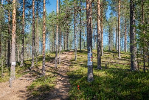
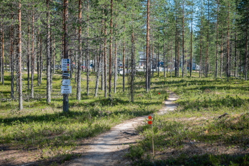
The first part of the route runs from the pine-forest needle trails in the vicinity of the Hossa Visitor Centre through Iikoski River. After the River Iikoski route follows the shores of Lake Huosiusjärvi to the Torkonluikea River and from there climbs up to the Hakoharju ridge and turns to the left towards Hossa Visitor Centre.
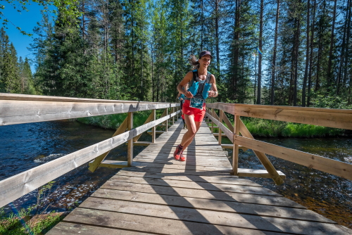
The first 200 meters and steps runners will have on the asphalt-paved Jatkonsalmentie, after which the running route leads to the needle trail next to the Road Iikoskentie. Trail follows very closely the Road Iikoskentie about 1.5 km until the crossing of the Iikoski bridge.
The only asphalt section of the route is on the Kainuu Trail's start (approx. 200 m)
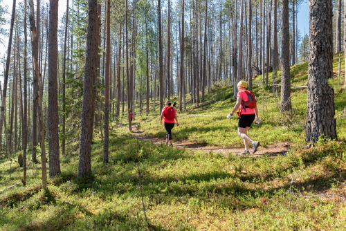
Immediately after crossing the Iikoski bridge, the route turns sharply to the left towards Lake Huosiusjärvi. This needle path, which teases the feet and eyes of a trail runner, runs in a pine-forest and it lasts about 3.5 km to the western end of Lake Huosiusjärvi. At the end of the section, the route crosses the Torkonluikea rapids, and immediately after crossing the rapids, the first slightly tighter ascent of Hakoharju, about 150 m long and 25 m high, is coming up.
Crossing the River Torkonluikea at the western end of Lake Huosiusjärvi
Ascent to the ridge Hakoharju right after the crossing of river Torkonluikea
On the Hakoharju ridge, the 10 k route turns sharply to the left towards Hossa Visitor Centre as the other routes 38, 55, 78 k are turning right. So far, the running distance from the start is 5.4 km.
On the Hakoharju ridge the trail is leading slightly to downhill about 500 meters
where other tracks (ending sections of 21, 38, 55 and 78 k) are joined into a 10 k route at the Lake Huosiusjärvi campfire site. From here starts a 4 k long section towards the finish.
After the Lake Huosiusjärvi campfire site the route continues towards Jatkonsalmentie and the Huosivirta bridge, which is located in the northern corner of Kenttäjärvi (see map).
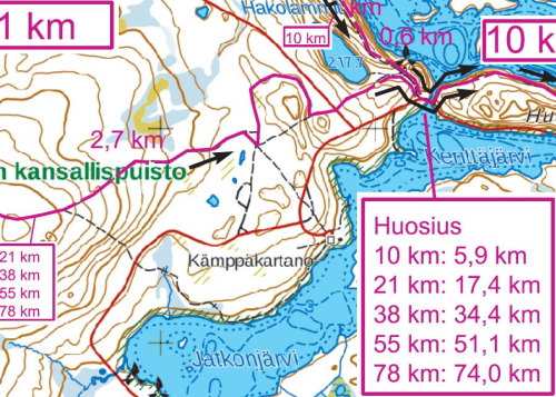
At Huosius, all Kainuu Trail routes will have 4 kilometers into finish
Good to know: As a result of the customer feedback we received after the first Kainuu Trail in 2021, we have now added an independent water point (not an official aid station) to Huosivirta bridge starting from 2022. This additional water refilling place will serve all participants in the Kainuu Trail, regardless of the track.
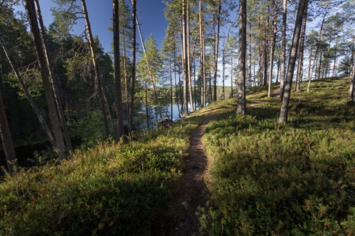
After crossing the Huosivirta bridge, the route turns sharply to the left along small stairs that rise towards Huosiharju. In the last four kilometers before the finish, the Kainuu Trail runners will get an experience to “enjoy” the surprisingly tense ascents and descents of Huosiharju. Although this section is surprisingly tough and tests the endurance of the trail runner's physical and mental capacity, Huosiharju’s eye-catching postcard landscapes with the crown of the Huosilampi pond’s landscape will provide strength and energy for the last meters. From Huosilampi shore you can already hear the Kainuu Trail’s speaker calling from the finish and competition centre.
The Kainuu Trail route on the east side of the Huosivirta stream (Photo: Suomussalmi municipality / photographer: Antti Kulmanen)
In the northern corner of Huosilampi pond, the route turns sharply to the right to turn south and to circle around Huosilampi (background you can see Huosilampi)
Huosilampi will be circled around almost completely before reaching the finish line
Huosilampi view about 1 kilometer before the Kainuu Trail finish
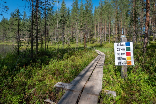
Duckboards and Kainuu Trail signs guides towards the finish (500 m before finish)
The last ascent is 250 meters before finish
There it is - Kainuu Trail finish
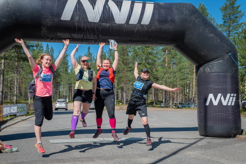
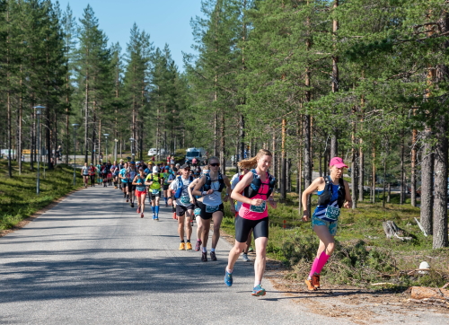
Kainuu Trail 2021 10 k’s runners after the finish line
Get familiar with the Kainuu Trail distances, routes and maps
Read the Kainuu Trail race instructions
See from here Kainuu Trail aid stations
Check out Kainuu Trail equipment and gear
Kainuu Trail entry and registration
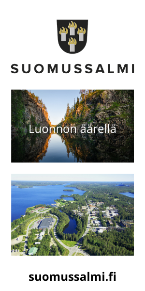
Welcome to enjoy trail running in the beautiful Hossa National Park, Kainuu, Finland!