


Kainuu Trail 21 km Jatkonvaara - a half marathon size trail running experience in Hossa’s nicest paths
Published: 29.03.2022
Kainuu Trail 21 km Jatkonvaara - a half marathon size trail running experience in Hossa’s nicest paths
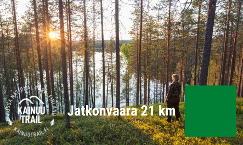
On the Kainuu Trail 21 k Jatkonvaara route a trail runner can enjoy Hossa’s nicest paths, most beautiful ridges and the Jatkonvaara hill area’s spectacular views. In this route description, we’ll tell you the most important terrain and route hints to make you prepare for this 21 k trail running a little bit easier.
Kainuu Trail 21 k
Distance: 21.00 km
UTMB Qualifier 2022: Qualifier 20K
ITRA-points: 1
Mountain-points: 3
Total elevation: +620 m
Aid stations: 1 + finish
Start and finish area: Hossan Visitor Centre
Start time: saturday at 09.30am
Maximum time: 7 h (finish is closed at 22.00pm)
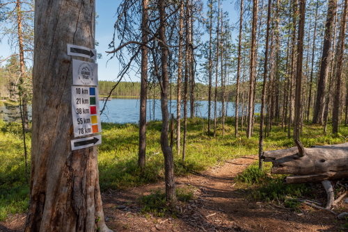
Route markings: Green
Route map: See route map from here
More info: Kainuu Trail routes and maps -webpage
Presentation video: Kainuu Trail 21 k presentation video
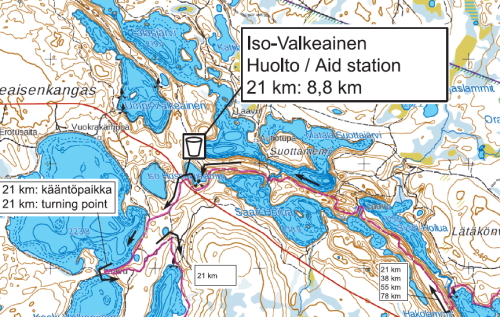
Start - Iso-Valkeainen (1st Aid station), 8.8 km
The first part of the route runs from the pine-forest needle trails in the vicinity of the Hossa Visitor Centre through Iikoski River, following the shores of Lake Huosiusjärvi to the Torkonluikea River and from there along Hakoharju ridge towards the first aid station (service point) in Iso-Valkeainen.
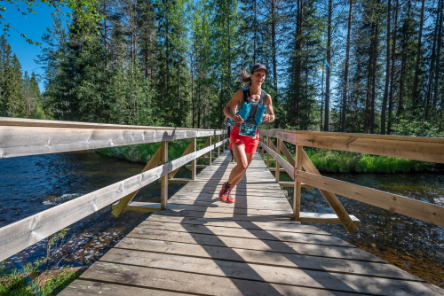
The first 200 meters and steps runners will have on the asphalt-paved Jatkonsalmentie, after which the running route leads to the needle trail next to the Road Iikoskentie. Trail follows very closely the Road Iikoskentie about 1.5 km until the crossing of the Iikoski bridge.
The only asphalt section of the route is on the Kainuu Trail's start (approx. 200 m)
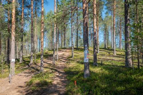
Immediately after crossing the Iikoski bridge, the route turns sharply to the left towards Lake Huosiusjärvi. This needle path, which teases the feet and eyes of a trail runner, runs in a pine-forest and it lasts about 3.5 km to the western end of Lake Huosiusjärvi. At the end of the section, the route crosses the Torkonluikea rapids, and immediately after crossing the rapids, the first slightly tighter ascent of Hakoharju, about 150 m long and 25 m high, is coming up. On the Hakoharju ridge, the 21 km route (as well as the routes 38, 55, 78 km) turns sharply to the right backwards. So far, the running distance from the start is 5.4 km.
Crossing the River Torkonluikea at the western end of Lake Huosiusjärvi
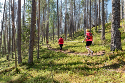
The next 3.4 km section will be enjoyed by the fine pine-dominated ridges and, in the meantime, by diving into the river rapids in the ridges. Absolutely great scenery points in this area are Hakokosket and Suottavirta.
Ascent to the ridge Hakoharju right after the crossing of river Torkonluikea
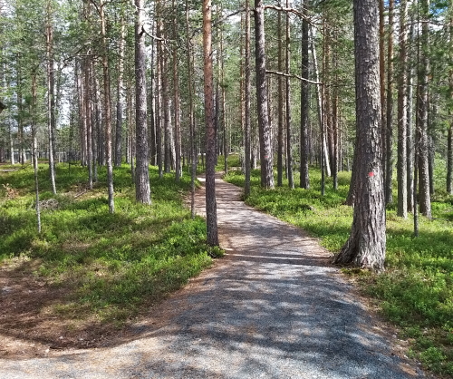
On the Hakoharju ridge the trail is traditional needle path type
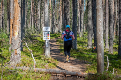
Of course, the scenery to Syvä-Hoilua from the top of Hakoharju, for example, is also quite amazing. About 400 m before the first aid station in Iso-Valkeainen, the route arrives at the edge of Pieni Hossalaislampi pond, from where it turns left to turn around the pond towards the first service. The route arrives at the aid station along a small path on the right side of a larger road (Pistonlehdontie). At the Iso-Valkeainen aid station, the Kainuu Trail trail’s distance is 8.8 km from the start.
Good to know: From Iso-Valkeainen aid station the 21 k route turns sharply to the left towards 21 k turning point near the Muikkupuro (see map). Instead, 38, 55 and 78 k distances routes are turning right to follow the road Pistonlehdontie.
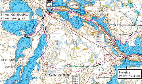
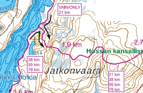
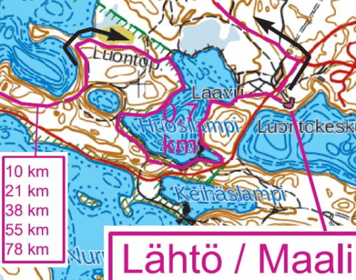
Kainuu Trail 21 k Jatkonvaara route map
Iso-Valkeainen - Muikkupuro - Jatkonvaara - Huosius, 8,6 km (total 17,4 km)
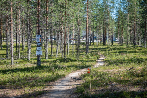
After the aid station visit to Iso-Valkeainen, the runners head towards the 21 k’s turning point located near the legendary Muikkupuro and its crystal clear natural waters. Muikkupuro is about 1.5 km from the Iso-Valkeainen and mostly at this section runners can enjoy the very fine grounded trail.
Path to Muikkupuro is mostly in very good shape
The last 400 meters before Muikkupuro, a 21 km track runs to a little bit smaller path and to the shore of Iso-Valkeainen, but this smaller path is also in a very pleasant running condition - like all other needle paths in Hossa :).
Just before Muikkupuro, Kainuu Trail runners will enjoy this path
About 75 meters before arriving at the lean-to a shelter of Muikkupuro, there is a turning point on the 21 k route, where the 21 kilometer route turns sharply to the left from the t-junction of the trails and from there towards the northern end of Lake Pitkä-Hoilua and further on towards Jatkonvaara (see map).
Good to know: The 21-kilometer running route does not continue to the lean-to a shelter of Muikkupuro, but turns sharply to the left about 75 meters before Muikkupuro.
21 k turning point is about 75 meters before Muikkupuro
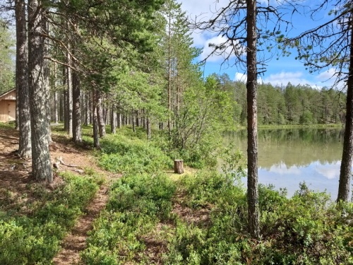
Nice shore view of the Lake Keski-Valkeainen near the Muikkupuro (Photo: Kainuu Trail / Jukka Liuha)
From the turning point of the 21 k’s route, the route continues towards Lake Pitkä-Hoilua and Jatkonvaara. At the intersection of this turning point, the 21-kilometer route arrives from the direction of the path shown in the lower left corner of the picture and continues in the direction shown in the picture (Photo: Kainuu Trail / Jukka Liuha)
After the turning point, it is about 1 km running to the end of Lake Pitkä-Hoilua. At the northern end of Lake Pitkä-Hoilua, the running route goes between a wilderness cottage and a campfire site to the east side of Lake Pitkä-Hoilua towards the t-junction that turns to Jatkonvaara.
The Kainuu Trail’s track on the shore of Lake Pitkä-Hoilua is enjoyed for about 1 kilometers, after which 21 k’s runners turn 90 degrees to the left towards Jatkonvaara (see map).
At this crossing, the 21 k’s route meets 38, 55 and 78 km routes. Both routes turn towards the Jatkonvaara.
Good to know: At this crossing, the official hiking trail continues straight to the south, but the 21 km Kainuu Trail signs do not guide you to run straight, but instead turn left towards the ascent of Jatkonvaara hill. The Kainuu Trail 38, 55 and 78 k’s track will come from the opposite direction of the Pitkä-Hoilua’s shore path to the same crossing, but these signs will only be visible from the south for 38, 55 and 78 k runners. The crossing also has a “traffic divider” made of signposts so that runners arriving from both directions turn towards the ascent of Jatkonvaara.
After the crossing, the trail heads towards Jatkonvaara and there will be a one kilometer long continuous ascent (total elevation 60 meters) to the top of the hill. On top of the hill, the path dives into a small slope, from where it ascends another steep climb to the crossroads of Kainuu Trail and the Hossa’s official hiking trail. This path from Pitkä-Hoilua to the intersection of the official hiking route is one of the weakest (in condition) in Kainuu Trail (but still runnability is good); the path is in a weak condition because it has not been an official hiking route since 2017.
Down from the top of the Jatkonvaara hill, runners can enjoy comfortable and relaxed downhill running towards Huosius. About 500 meters before Huosius, the route crosses the dirt road Pistonlehdontie and a few hundred meters later it joins the 10 k track’s route at the Lake Huosiusjärvi campfire site. Here it turns right towards Jatkonsalmentie and the Huosivirta bridge, which is located in the northern corner of Kenttäjärvi (see map).
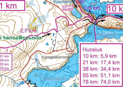
At Huosius, all Kainuu Trail routes will have 4 kilometers into finish
Good to know: As a result of the customer feedback we received after the first Kainuu Trail in 2021, we have now added an independent water point (not an official aid station) to Huosivirta bridge starting from 2022. This additional water refilling place will serve all participants in the Kainuu Trail, regardless of the track.
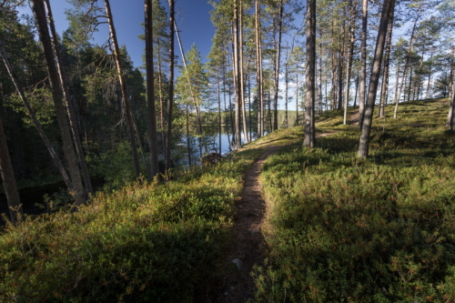
After crossing the Huosivirta bridge, the route turns sharply to the left along small stairs that rise towards Huosiharju. In the last four kilometers before the finish, the Kainuu Trail runners will get an experience to “enjoy” the surprisingly tense ascents and descents of Huosiharju. Although this section is surprisingly tough and tests the endurance of the trail runner's physical and mental capacity, Huosiharju’s eye-catching postcard landscapes with the crown of the Huosilampi pond’s landscape will provide strength and energy for the last meters. From Huosilampi shore you can already hear the Kainuu Trail’s speaker calling from the finish and competition centre.
The Kainuu Trail route on the east side of the Huosivirta stream (Photo: Suomussalmi municipality / photographer: Antti Kulmanen)
In the northern corner of Huosilampi pond, the route turns sharply to the right to turn south and to circle around Huosilampi (background you can see Huosilampi)
Huosilampi will be circled around almost completely before reaching the finish line
Huosilampi view about 1 kilometer before the Kainuu Trail finish
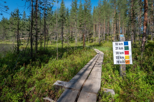
Duckboards and Kainuu Trail signs guides towards the finish (500 m before finish)
The last ascent is 250 meters before finish
There it is - Kainuu Trail finish
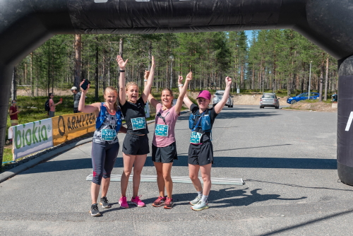
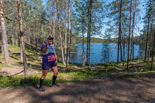
Kainuu Trail 2021 runners after the finish line
Get familiar with the Kainuu Trail distances, routes and maps
Read the Kainuu Trail race instructions
See from here Kainuu Trail aid stations
Check out Kainuu Trail equipment and gear
Kainuu Trail entry and registration
Welcome to enjoy trail running in the beautiful Hossa National Park, Kainuu, Finland!